 Book
Book 


Articles
April 29, 2026
The best moments of the winter season
The sun is warming the fir trees. The snow is melting, giving way to flowering pastu…
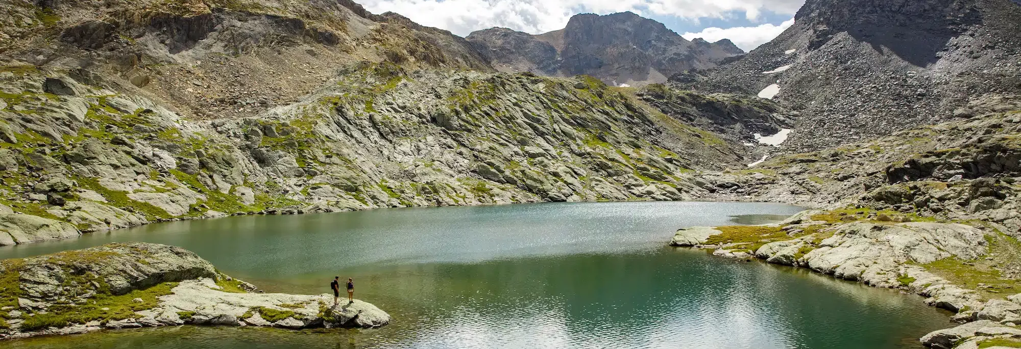
The Méribel valley and the Vanoise National Park are home to a wealth of high-altitude lakes, each one a majestic site waiting to be discovered. Across the Méribel valley alone, you’ll find more than a dozen mountain lakes, including the stunning Lac du Mont Coua, perched above 2,500 metres, the mystical Lac des Fées, a favourite haunt of marmots, and the ever-popular Lac de Tuéda, nestled at the heart of the Plan de Tuéda nature reserve. This last one remains easy to reach, but it’s really towards its more secluded, harder-to-reach neighbours that this article will take you.
Discover all the ways to go hiking in the heart of the Alps, whether guided or independent, on a day trip or with a night spent in a mountain refuge, along easy paths or more demanding routes, there’s no shortage of ways to explore these captivating mountain lakes.
Lac de Chanrouge and many more
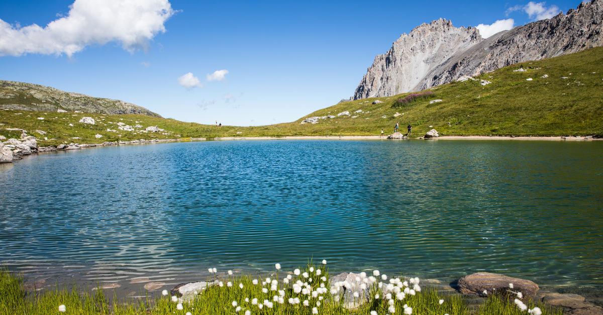
Lying at the edge of the Plan de Tuéda Nature Reserve, the refuge du Saut is the ideal base for all walkers and lovers of wild mountainous areas. From here, you can easily explore all the rich and varied wildlife, flowers and landscapes of the Vanoise National Park on a half- or full-day walk. For example, you can ascend the impressive col Rouge with a pause at the lac de Chanrouge where you can often spot ibex.
You could also walk to the immense Gebroulaz glacier, the source of the Doron river, and either content yourself with admiring its ice from below or, if you are feeling bold, by climbing up to le col du Souffre. Or you could cross le mont Coua in search of its six lakes in a sumptuous high mountain setting.
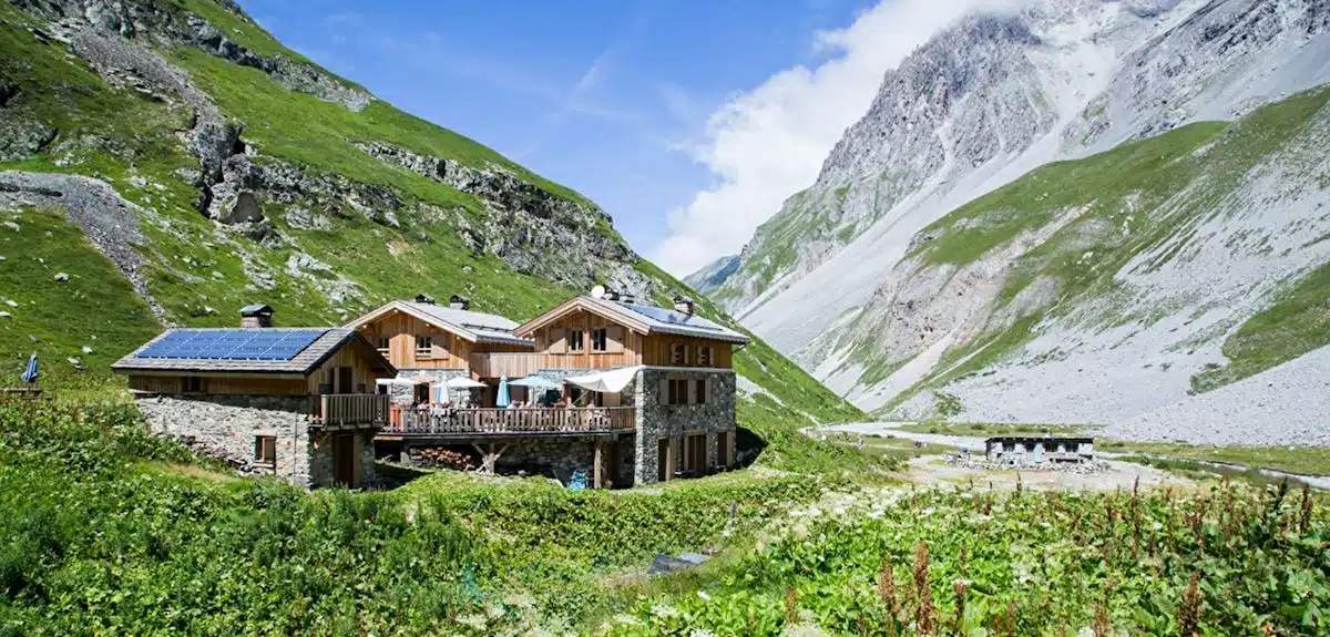
The refuge du Saut is eco-friendly: it uses solar panels and wind-turbine driven ventilation; drinking water is treated on site; sanitation is treated nearby; and wood is used for heating. It can take up to 25 people in comfortable accommodation of modern standards.
You can reach it easily from le lac de Tuéda (allow around 2 hours and follow the signs). For example, take the green Tuéda circular walk given above.
6 lakes in an exceptional wild landscape
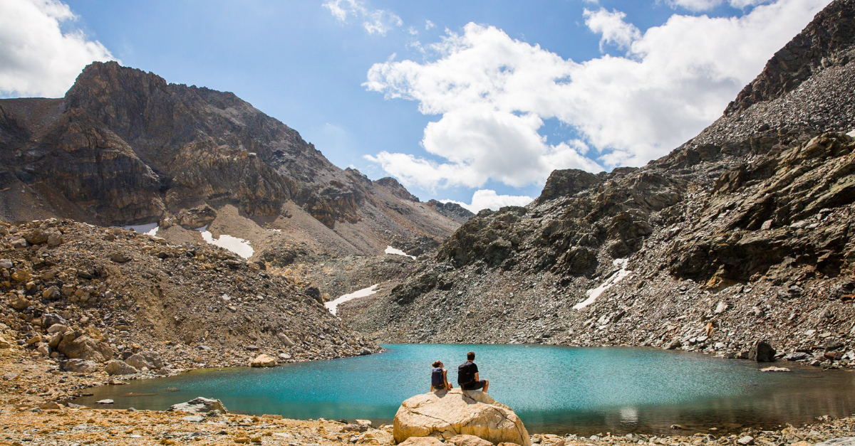
From le Plan and le lac de Tuéda, this walk over le Mont Coua and to its lakes takes approximately 7 hours with a total ascent of 1,000m. It can be achieved in one day by experienced walkers. For a gentler and more contemplative immersion in the mountains, you can take two days to complete the walk by spending one night in le refuge du Saut.
This walk will allow you to admire numerous lakes including the six spectacular Mont Coua lakes which lie between 2,520 and 2,820m in a striking, rocky setting.
📍 Step 1 :
From the plan Ravet car park in Mottaret (1,681m), set out towards the refuge du Saut, passing by the lac de Tuéda. After the lake, continue towards the refuge du Plan, then the refuge du Saut (signposted), climbing some fairly steep passages. Enjoy a breather along the flat Vallon du Fruit area, by the meandering Doron des Allues river as it flows through the green and flowery pastures.
Don’t miss the discrete but nonetheless superb lac des Fées, hidden to the right of the path. Rejoin the path which rises and passes through a narrow gully before reaching le refuge du Saut (2,140m). Spend the night at the refuge.
⌛ Around 2h
🏔️ Elevation gain : 450m
📍 Step 2 :
From le refuge du Saut, follow in the direction of Col du Soufre and climb up to the footbridge over the Doron des Allues (2,440m). After the footbridge take the path to the left (East) towards the lacs du Mont Coua. This is not marked, but the trail is clearly visible. After the first small lake, a little off the path, you will reach the second lake. Follow the little path and the cairns on the right (south-east) towards the largest lake (2,672m); this lake is highly prized by fishermen. After the large lake, continue along the little path following the cairns (south-east) towards the fourth and the fifth lakes (2,780m). You can, if you have enough time and the weather is favourable, continue to the sixth lake…
Above the fifth lake, find the le petit collet (2,787m) to the north (Passage des Eaux Noires), indicated by large cairns. Go down into the valley on the right of the Mont Coua cliffs. You will see numerous cairns in the beautiful, ochre-coloured scree. There are a few steep passages but no technical difficulties through this scree. This route does not appear on the IGN maps (the blue marks indicate a ski touring route). There is no difficulty in finding your direction: simply go down into the valley (north) and at the bottom you’ll find greenery and the marked path that leads to the col Rouge.
⌛ Around 4h
🏔️ Elevation gain: 700m
📍 Step 3 :
Head back down from the Refuge du Saut via the Plagne plateau and the Bois des Ramées, most of the descent shaded by the forest before reaching Méribel-Mottaret. Don’t underestimate this final stretch, the first two legs of the hike are already demanding enough as it is.
⌛ Around 2h
🏔️ Elevation gain : 450m
🥾 Day 1
Meet at the plan Ravet cark park and start from the lac de Tuéda and head towards the refuge du Saut. When you arrive on the plateau de la Plagne, continue to the edge of the plateau to discover the crystalline lac des fées that is hidden on the right, 50m from the path. Continue to the refuge du Saut then follow the directions towards le lac de Chanrouge. You can sometimes see Ibex here. Rejoin the path that leads to the col de Chanrouge and head towards the lacs Merlet. The path goes along the valley then climbs to les lacs Merlet.
Spend the night at le refuge des lacs Merlet (nb: book in advance).
⌛Around 5h from Lac de Tuéda > refuge des lacs Merlet
🥾 Day 2
From the refuge, go over the cols de la Platta, de Chanrossa and then du Fruit before descending to Méribel-Mottaret, passing by lac Tuéda.
⌛ Around 4h from refuge des lacs Merlet > Lac de Tuéda

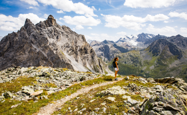

For experienced hikers
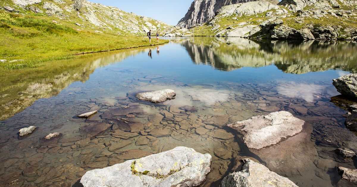
This long walk, which takes on average 9 hours, will allow you to discover the most beautiful lakes in the Plan de Tuéda Nature Reserve and the Méribel valley
📍 Step 1 :
At the entrance to the Nature Reserve (start from the plan Ravet car park) follow the tarmac road for 50m before the toilets, a small path sets out on the left, and joins a hairpin bend on the road to le Châtelet. Go along this and then head in the direction of le Refuge du Saut, 50m after the last garages on the right, by going around and behind the last buildings of le Châtelet. Cross a little stream, then follow the path towards the refuge du Saut until it opens out at the large plateau de la Plagne.
Descend to the plateau and cross the footbridge to join the main track, still heading in the direction of the refuge. Continue along the plateau to the chalets de la Plagne and head in the direction of le col du Vallon (2,394m). Once you reach the pass, go towards the left, ignoring the path to the side which leads to the old mine.
⌛ Around 3h
📍 Step 2 :
The path climbs up to a vast scree from the Mont Vallon just above the lac du Vallon. Follow the path around the mountain, it passes underneath the gondola ski lift amongst large blocks of rock and skirts the Mont du Vallon, offering a view over the entire valley, and leads to the lacs du Borgne (2,552m).
This rocky area is dominated by the glacier du Borgne. The path crosses the scree as far as the foot of the col de la Chambre and continues up the left of a large slope which in winter forms a ski run. In just 15 minutes you will reach the magnificent lac de la Chambre (2,637m).
⌛ Around 2h30
📍 Step 3 :
Retrace your steps for a few minutes back to the junction, then head left towards Côte Brune, Plan des Mains, Mûres Rouges and Plan de Tuéda.
Between Plan des Mains and Mûres Rouges, the trail follows the river, where arolla pine roots weave a lovely natural pattern along the banks. To make your way back from Mûres Rouges to Tuéda, you can either take the shaded Bois de la Ramée route, or follow the Plan de Tuéda path past the Refuge du Plan, stopping there or not, depending on the mood.
⌛ Around 3h30
The Méribel Tourist Office has put together practical hiking guides, complete with marked trails, expert tips and useful contacts to help you set off well prepared. So whether you go it alone or with one of our guides, come discover the lakes, the wildlife, the flora, and why not even a night at a mountain refuge!
Before you head out, find out how to best prepare for your mountain outing, and discover the route that’s right for you.
The best moments of the winter season
The sun is warming the fir trees. The snow is melting, giving way to flowering pastu…
A ski holiday in the heart of Les 3 Vallées
Welcome to the heart of the world’s largest ski area!

The Art of Après-Ski in Méribel
The day is drawing to a close, the sun is setting behind the ridge and you have disc…
A relaxing break in Méribel
Winter in the mountains isn't only about hurtling down the slopes!