 Book
Book 


Articles
July 13, 2026
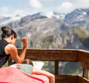
The art of relaxation in Méribel
In summer, life in the mountains moves at a slower pace.
L’origine du nom Méribel, qui signifie “le point d'où la vue est belle”, est en elle-même une indication : Méribel est une destination photogénique et a fortiori très instagrammable.
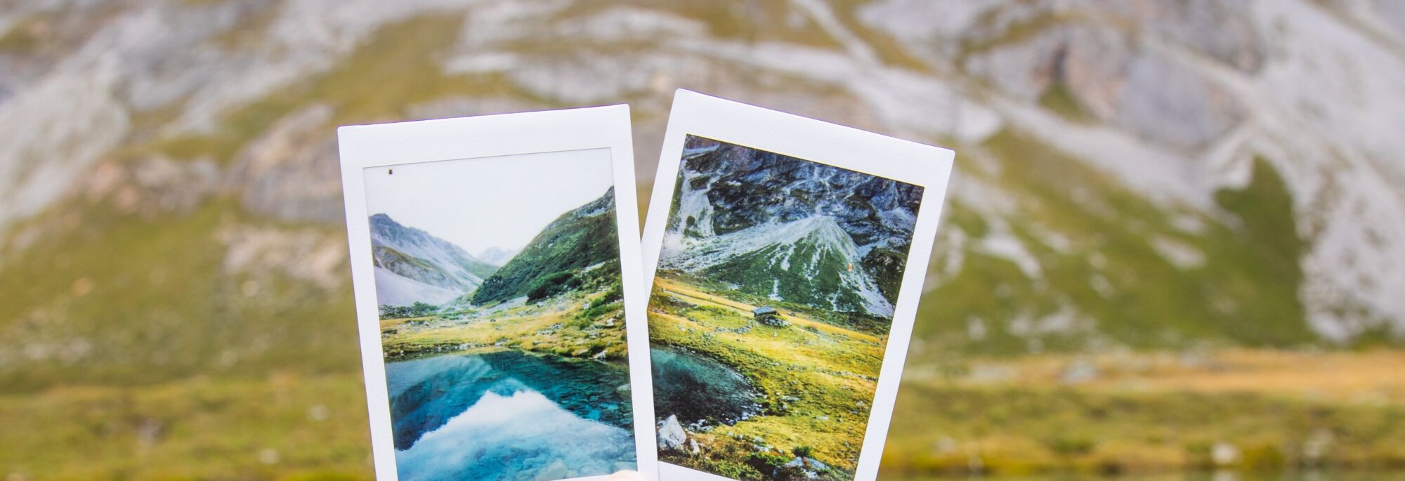
The origin of the name Méribel, which means “the point from which the view is beautiful”, says it all: Méribel is a very photogenic destination and consequently very “Instagrammable”.
If you come to Méribel this summer, you can take advantage of the amazing setting to take holiday photos that will stand out from the crowd! These photos will immortalise precious moments and you are sure to look back on them with pleasure for years to come.
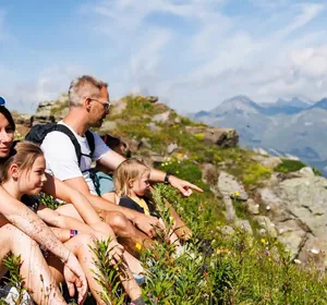
Whether it’s for a romantic selfie or a photo with your family, we’ve identified 4 Instagram worthy spots in Méribel, peaceful and easy to access, for a photo session in the heart of magnificent landscapes. Don’t forget your selfie stick or camera stand, and express your inner photographer.
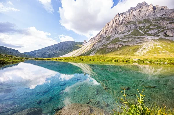
GPS coordinates: 45°21'47.1"N 6°35'07.3"E
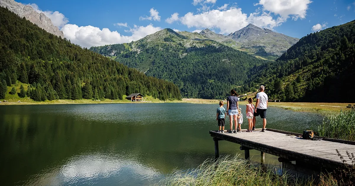
This fishing pontoon offers you a first-class view of the beautiful Lake Tuéda. Thanks to this wooden platform in the water, the lake will make a sublime backdrop for your holiday photo.
Located at the entrance to the Tuéda nature reserve, the lake is easily accessible from Méribel-Mottaret. It is therefore naturally the ideal place for a family outing: a restaurant, picnic tables, a traditional farm and a marked botanical trail which allows you to discover more than 80 species…
The departure is from Méribel-Mottaret from the Plan Ravet car park located at the entrance to the Plan de Tuéda nature reserve. From this car park, you can walk to the lake in 10 minutes.
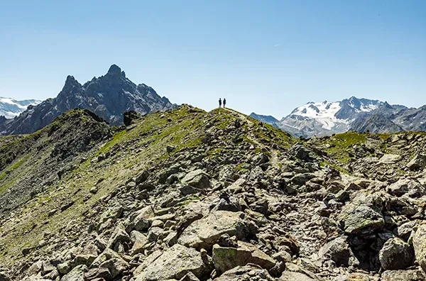
GPS Coordinates: 45°21’43.8″N 6°37’16.6″E
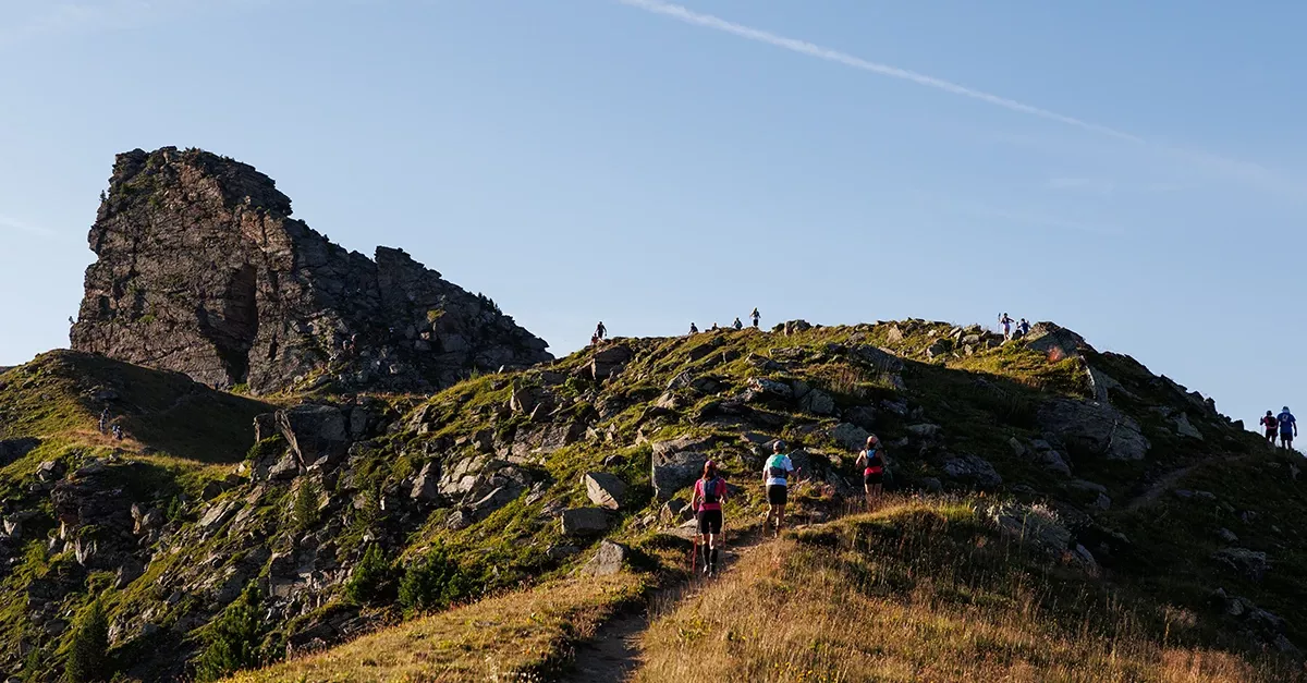
Following the ridges of the Fruit summit, you can reach the pass of the same name which culminates at 2,516 metres. Numerous photo locations await you on this route, all you have to do is choose your background: the valley, the Aiguille du Fruit, Mont Vallon, Mont Blanc or even the splendid Gébroulaz glacier.
The starting point is Méribel-Mottaret by the Pas du Lac cable car. From the top of the second section, you have a 45 minutes walk to the Petite Saulire, then roughly 30 minutes along the ridge brings you to the Col du Fruit.
GPS coordinates GPS : 45°20’44.6″N 6°37’01.1″E
The Lac des Fées is located on the Plagne plateau. Its water, of an incredible transparency, offers great photo opportunities. With the help of an action camera or a waterproof protection, play with the water to immortalise this moment: your feet in the water and your head in the mountains.
It takes roughly 1 hour 30 minutes to walk to the Lac des Fées from the car park in Méribel-Mottaret, at the entrance to the Plan de Tuéda nature reserve. This small lake is located at the bottom of the plateau, 30 metres to the right of the path. It is not directly visible from the path, will you find it?
GPS coordinates: 45°35’69.37”N, 6°56’29.32”E
The Tougnète ridge links the Tougnète summit to the Mont de la Challe, between the Belleville valley and the Méribel valley. In the middle of this ridge is the Tougne rock, a particularly impressive limestone formation. Along this path you can see on one side the Mont Blanc, the Aiguille du Fruit and the Dent de Burgin, and on the other side the Belleville valley, the Dôme and the Barre des Écrins or the Aiguilles d’Arves.
Why not go there for the sunset? The Tougnète ridge offers unforgettable colours. Photographers call this moment “the Golden Hour”, a magical moment that will bring a soft, golden light to your holiday photos. Early risers can also enjoy a superb sunrise on the Aiguille du Fruit.
Take the Tougnète 1 and 2 lifts. Then, once at the top, take the direction of Mont de la Challe on the left as you leave the chairlift. It takes 30 minutes to reach the Roc de Tougne and another 45 minutes to reach the Mont de la Challe. You can also join the path by walking from the hamlet of Mottaret (1h30). The descent is made on foot or by chairlift.
The art of relaxation in Méribel
In summer, life in the mountains moves at a slower pace.
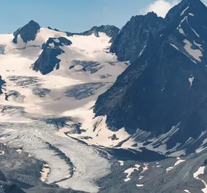
Glacier trekking at 3,000m
Some hikes stay with you long after, and the ones that start with crampons on, in th…
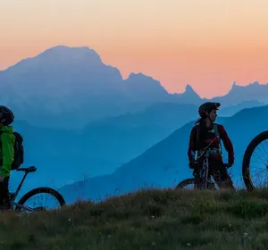
Downhill mountain biking: debunking the myths
Even before people have had a go, the words "downhill mountain biking" are enough to…
A week in Méribel with the family: two approaches…
Can you feel that sense of lightness in the air, right from the moment you set foot…